

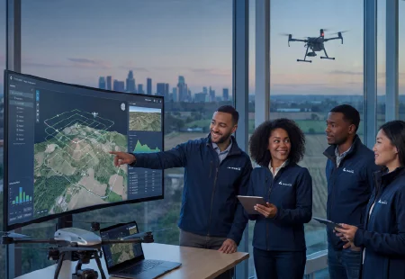
As industries continue to pursue digital transformation, 3D digital twin solutions are becoming a critical technology for connecting physical environments with intelligent decision-making systems. Unlike traditional digital models that only display static information, modern digital twins combine 3D reconstruction, artificial intelligence, geographic data, and real-time analysis to create dynamic representations of real-world assets and environments.
Across sectors such as energy, infrastructure, mining, emergency response, and urban management, organizations are adopting digital twin technologies to improve visibility, reduce operational risks, and optimize resource management. Supported by advancements in drone photogrammetry and spatial AI, these solutions are helping enterprises move from data collection toward actionable intelligence.
Smart Cities Use 3D Digital Twin Solutions for Urban Management
Urban environments are among the earliest adopters of 3D digital twin solutions because cities require accurate and continuously updated information for planning and governance. Traditional surveying methods often struggle to provide fast updates for large and complex urban areas.
By integrating aerial imagery, 3D modeling, and AI-based analysis, digital twins allow city managers to visualize buildings, roads, infrastructure, and public spaces in a unified digital environment. These models support applications such as illegal construction detection, urban planning, and infrastructure monitoring.
Solution providers are increasingly helping governments create more efficient management systems by transforming scattered geographic data into structured intelligence. The result is improved decision-making and better coordination between different departments.
Energy Companies Improve Asset Inspection and Safety
The energy sector faces challenges when managing large-scale assets such as pipelines, power facilities, and renewable energy installations. Manual inspection processes can be time-consuming and may expose workers to hazardous environments.
These solutions enable energy companies to build detailed digital representations of their assets through drone-based data collection and AI analysis. Engineers can inspect conditions remotely, identify potential issues, and track changes over time.
For example, aerial data combined with spatial intelligence can support pipeline inspection by creating accurate 3D environments and identifying abnormalities. This approach improves inspection efficiency while reducing dependence on manual field operations.
Mining Industry Creates Safer Digital Operations
Mining is another industry where digital twins are delivering significant value. Open-pit and underground mining operations involve constantly changing terrain, equipment movement, and safety challenges.
Modern mining companies are using digital twin platforms to monitor production areas, analyze terrain changes, and support operational planning. Through drone surveying and AI-powered modeling, teams can obtain updated site information without frequent manual measurements.
Icecypress Technology provides mining digital twin solutions that combine drone surveying, AI analytics, and 3D visualization to support mine monitoring and lifecycle management. Its approach helps transform complex mining environments into measurable and manageable digital spaces.
Emergency Response Gains Faster Situational Awareness
During natural disasters, emergency teams need accurate information quickly. Damaged infrastructure, difficult terrain, and limited visibility can make traditional assessment methods ineffective.
A 3D digital twin solution helps emergency organizations rapidly reconstruct disaster areas using aerial imagery and intelligent processing. These digital environments provide rescue teams with better situational awareness and support more informed decisions.
This company applies drone swarm systems and AI processing capabilities to support emergency scenarios. Its solutions can generate 2D and 3D models from aerial data, helping teams understand changing environments during critical operations.
Infrastructure Projects Benefit from Digital Lifecycle Management
Large infrastructure projects require accurate information throughout planning, construction, and maintenance stages. Engineers and project managers need reliable data to track progress and identify potential problems.
3D digital twin solutions provide a visual foundation for infrastructure management by combining spatial data with intelligent analysis. Construction teams can compare real-world conditions with project plans, while operators can continue using digital models after completion.
This lifecycle approach allows infrastructure owners to improve maintenance strategies, reduce unexpected failures, and extend asset performance.
Public Safety and Security Applications Expand
Public safety organizations are increasingly exploring digital twins for monitoring complex environments. Airports, industrial zones, and large public spaces require accurate spatial information to improve security and operational efficiency.
Through AI-powered recognition and 3D reconstruction, digital twin platforms can help identify changes, analyze movement patterns, and provide valuable information for security planning.
Digital twin solution providers are developing systems that combine UAV technology, edge computing, and artificial intelligence. These innovations help organizations process information more quickly and improve response coordination.
Agriculture and Natural Resource Management Adopt Digital Twins
Agriculture and environmental management are also benefiting from digital twin technologies. Large-scale land monitoring requires frequent updates that are difficult to achieve through conventional methods.
With drone photogrammetry and AI analysis, organizations can create accurate digital representations of farmland, forests, and natural resources. These models support resource assessment, environmental monitoring, and long-term planning.
By combining spatial intelligence with real-world data, digital twins provide a clearer understanding of complex ecosystems and help organizations make more sustainable decisions.
Building the Digital Foundation for Future Industries
The adoption of these solutions across seven major industries demonstrates a shift toward intelligent management based on accurate spatial understanding toward intelligent management based on accurate spatial understanding. As businesses demand faster analysis and more efficient operations, digital twins are becoming an essential tool for connecting physical environments with digital intelligence.
Among emerging technology companies, Icecypress Technology focuses on integrating 3D, AI, and low-altitude aerial data to create complete spatial intelligence solutions. Its product ecosystem includes systems such as Mirauge3D Automatic 3D Modeling System, Rusa Rapid 3D Scene High-Fidelity Reconstruction System, and DroneSwarm Real-Time Onboard Analysis System, supporting applications across infrastructure, energy, emergency response, and other fields.
With continued advances in AI and geospatial technologies, digital twin adoption is expected to accelerate. Organizations that establish accurate digital foundations today can improve their ability to manage complex environments as digital twin adoption continues to grow.
