

A positioning system determines where an object is located and, depending on its architecture, can also establish its orientation and timing. In modern industrial equipment, that information is more than a coordinate on a map. It can become the spatial reference used by machines to steer, automate movement, coordinate operations, or make decisions.
The difference is important for engineers and integrators of systems to comprehend. The geographic data is provided by a positioning system, the surrounding objects are identified by perception technologies, and changes in orientation are described by attitude sensors.
With specialised location, perception, attitude, global navigation satellite system (GNSS) receiver, antenna, and computation technologies, Archimedes Innovation’s product line reflects this differentiation.
What a Positioning System Actually Does?
At its simplest, a positioning system establishes an object’s geographic position relative to a defined reference. GNSS is commonly used as the primary source of location data, while differential techniques can refine the position obtained from satellite signals.
High-precision equipment can provide much more useful spatial information than conventional navigation devices. According to the company’s technical description, its positioning sensors use high-precision GNSS differential technology to obtain centimeter-level geographic positioning at the antenna surface and can also provide nanosecond time information.
That precision becomes particularly relevant when a machine must follow a planned path, maintain a controlled trajectory, or repeatedly operate at a defined location. Small positional errors that may be insignificant for consumer navigation can become operational issues for automated machinery.
Position information can also be combined with orientation data. A dual-antenna configuration, for example, can determine attitude information in addition to geographic position. This creates a more complete spatial reference for equipment that needs to know both where it is and how it is aligned.
How Positioning Data Is Generated and Refined?
Satellite signals provide the basic reference, but demanding industrial environments can introduce interference, signal obstruction, and other sources of uncertainty. A robust positioning architecture therefore depends on more than simply installing a GNSS receiver.
GNSS receivers can integrate positioning and orientation boards with communication interfaces such as 4G, radio, serial, CAN, and Ethernet. Such integration allows location and attitude information to move into the wider machine-control or application environment.
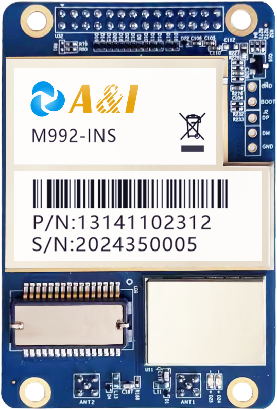
Inertial sensing provides another layer of information. GNSS and inertial measurement can be combined so that the system has additional motion-related information rather than depending exclusively on satellite-derived coordinates. Archimedes Innovation describes its M992-INS as a dual-antenna, tightly coupled GNSS-INS board designed for stable dual-band positioning in complex environments.
The antenna is also part of the overall measurement chain. Its position on the machine, signal environment, and relationship to other sensors can affect how spatial information is interpreted. Consequently, system design should consider the complete sensing architecture rather than evaluating a receiver as an isolated component.
Why Positioning Becomes More Valuable When Integrated?
Coordinates become operationally valuable when another system can act on them. An automated vehicle, agricultural machine, construction platform, or robot can use spatial information as an input to control logic, provided that the rest of the system is designed to interpret and respond to that data.
That is where positioning solutions move beyond simple location tracking. They can form one layer of a broader architecture involving perception, attitude sensing, communication, control, and computing. Archimedes Innovation presents these technologies as complementary components for intelligent systems rather than treating positioning as a standalone endpoint.
Perception serves a different purpose. Optical, electromagnetic-wave, and imaging technologies can detect targets or obstacles and provide environmental information. A machine may therefore use positioning to establish its own spatial reference while relying on perception to understand what surrounds it.
This distinction is especially important in autonomous applications. A machine needs to know its location, but safe and effective operation can also require awareness of obstacles, orientation, motion, and the intended task.
Where High-Precision Positioning Is Used?
Digital construction is one practical example. Heavy machinery may operate around complex structures or under conditions where visibility is compromised. The company’s digital construction offering combines high-precision GNSS and inertial technology to support machine guidance in these environments.
Agriculture presents another strong use case. Automated steering systems can use GNSS and IMU fusion to guide agricultural machinery. The AS10, for example, is described as an automated steering system for tractors, harvesters, and transplanters, combining GNSS and IMU technologies.
Autonomous vehicles and robots introduce broader requirements. Their spatial reference may need to work alongside perception and onboard computing so that positioning information contributes to navigation and autonomous decision-making.
The company’s portfolio includes positioning sensors, GNSS receivers, perception sensors, attitude sensors, and AI computing platforms for such integrated architectures.
Choosing the Right Architecture for the Task
Rather than starting with a specification sheet, the real operational requirements of the machine should be considered first when selecting a positioning system. In addition to determining if orientation data is required, engineers must determine the requisite positioning precision, operating environment, movement characteristics, available corrective services, and communication interfaces.
A construction machine working around obstructions may require a different architecture from an agricultural vehicle operating across open fields. An autonomous platform may require still broader integration because positioning must interact with perception and computing.
When a conventional product falls short of meeting application requirements, Archimedes Innovation offers both standard positioning technologies and customised solutions for B2B applications.
Ultimately, the right positioning solutions are those that deliver spatial information in a form the target machine can reliably use. Understanding that complete workflow—from signal acquisition and sensor fusion to communication and control—is more useful than viewing positioning as simply a method for finding coordinates.
